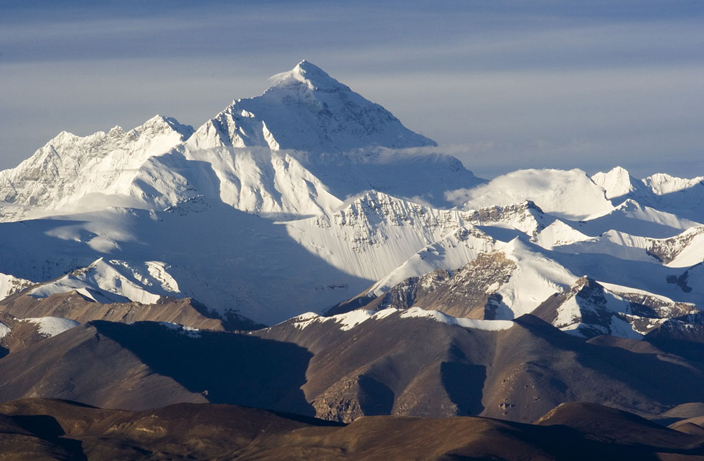


On Tuesday, China and Nepal jointly announced a revised height for Mt. Everest (also known as Mt. Qomolangma) at 8,848.86 meters (29,032 feet). The new official height is higher than both Nepal and China’s previous measurements.
CNN reports that the two countries have had a decade-long dispute over the height of the world’s highest peak, but finally agreed on a measurement on December 8.
The new height is less than a meter higher than the previously recognized height of the mountain from a 1955 Indian survey.
Both countries conducted their own surveys this year and analyzed their findings.
The latest survey combined traditional surveying and measuring techniques as well as advanced technology to ensure an accurate measurement. The survey also utilized China’s Beidou navigational satellites system for signals and data, in addition to gravity surveys.
Here’s an excerpt from CNN on how the final result was determined:
“The new height was calculated using a combination of geodetic data received from three mechanisms: leveling instrument, gravity meter and GPS. The team placed a signal receiver at every station, and measured how much time it took for signals to travel between the receiver and satellites — then converted that measurement into height.”
The mountain holds multiple names depending on the region, including Qomolangma in China, Sagarmatha in Nepal and Everest in the West. To learn more about these fascinating names, click here.
READ MORE: Everest, Qomolangma or Sagarmatha? Naming the World’s Highest Mountain
[Cover image via Wikimedia Commons]


0 User Comments