


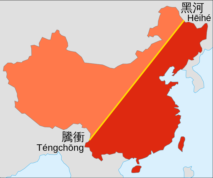
The Heihe-Tengchong line is an imaginary line that divides China diagonally into two, cutting across the country from Tengchong in Yunnan to Heihe in Heilongjiang, on the Russian border. To the east of the line is 43 per cent of the country's land and 94 per cent of the total population. To the west, 57 per cent of the land but only 6 per cent of the people.

The line was first imagined by National Central University population geographer Hu Huanyong in 1935, but just within the past day it has recaptured the attention of thousands on social media.
According to 1935 statistics, territory west of the line comprised 57 per cent of China's total area but only 4 per cent of the country's population. Despite mass migration of Han Chinese to the far west after 1949 and the exemption of minority peoples from planned birth policies, in 2002 still only 6 per cent of the population was in the west.
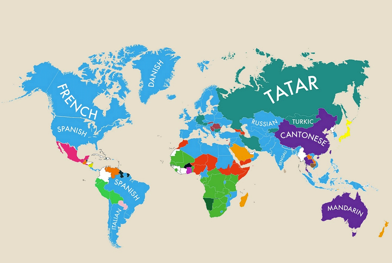
If you're a fan of population geography and infographics (and who isn't?) then you'll also love this map that captured the attention of people around the world this year:


0 User Comments