


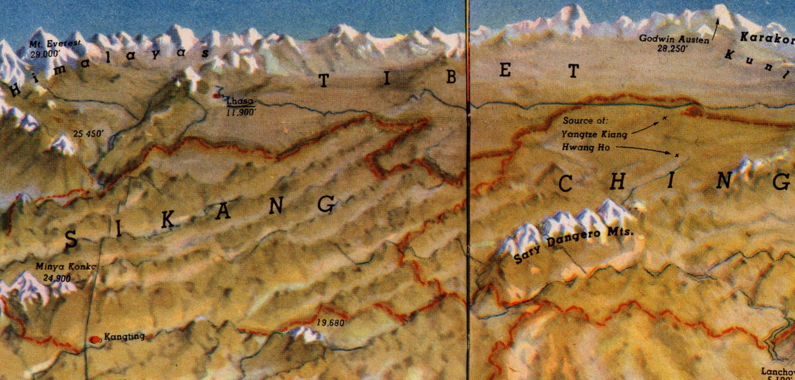
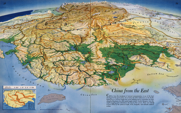
This 1941 map of the Republic of China differs from most in three big ways: 1) it's orientated from the east, placing the west rather than north at the top; 2) it offers an angled, bird's eye view rather than being straight down; and 3) the incredibly vivid topography of the map truly gives you a sense of China's tricky geography. Plus an insert in the bottom left showing the internal migration of China's key universities in wartime will also be of interest to history fans.
EXPLAINER: How every Chinese province really got its name
Even though the map is nothing new, it was just recently added to cartography fan group r/MapPorn, where users are saying that it finally illuminates for them things that they had heard about China but never truly appreciated...
To view a full-resolution version, click here.
These revelations include why Chinese civilization first sprung up in the Yellow and then Yangtze River valleys, and how unique branches of that civilization with mutually unintelligible languages developed in places like Fujian and Guangdong, isolated by mountain ranges; why Lord Palmerston wanted Captain Charles Elliot to take Zhoushan instead of Hong Kong in the First Opium War, and how important the Yangtze was for accessing the interior; how the Imperial Japanese Army got as far as it did in the Second Sino-Japanese War, and why Chiang Kai-shek breached the Yellow River dykes in 1938 to hold them at bay and retreat to wartime capital Chongqing; why the country tends to fracture along the same lines in periods of disunity; and how few expansive plains the country possesses, leading the vast majority of the population to concentrate in the littoral eastern regions.
MAPPING CHINA: The invisible line that divides 94% of China's people from the other 6%
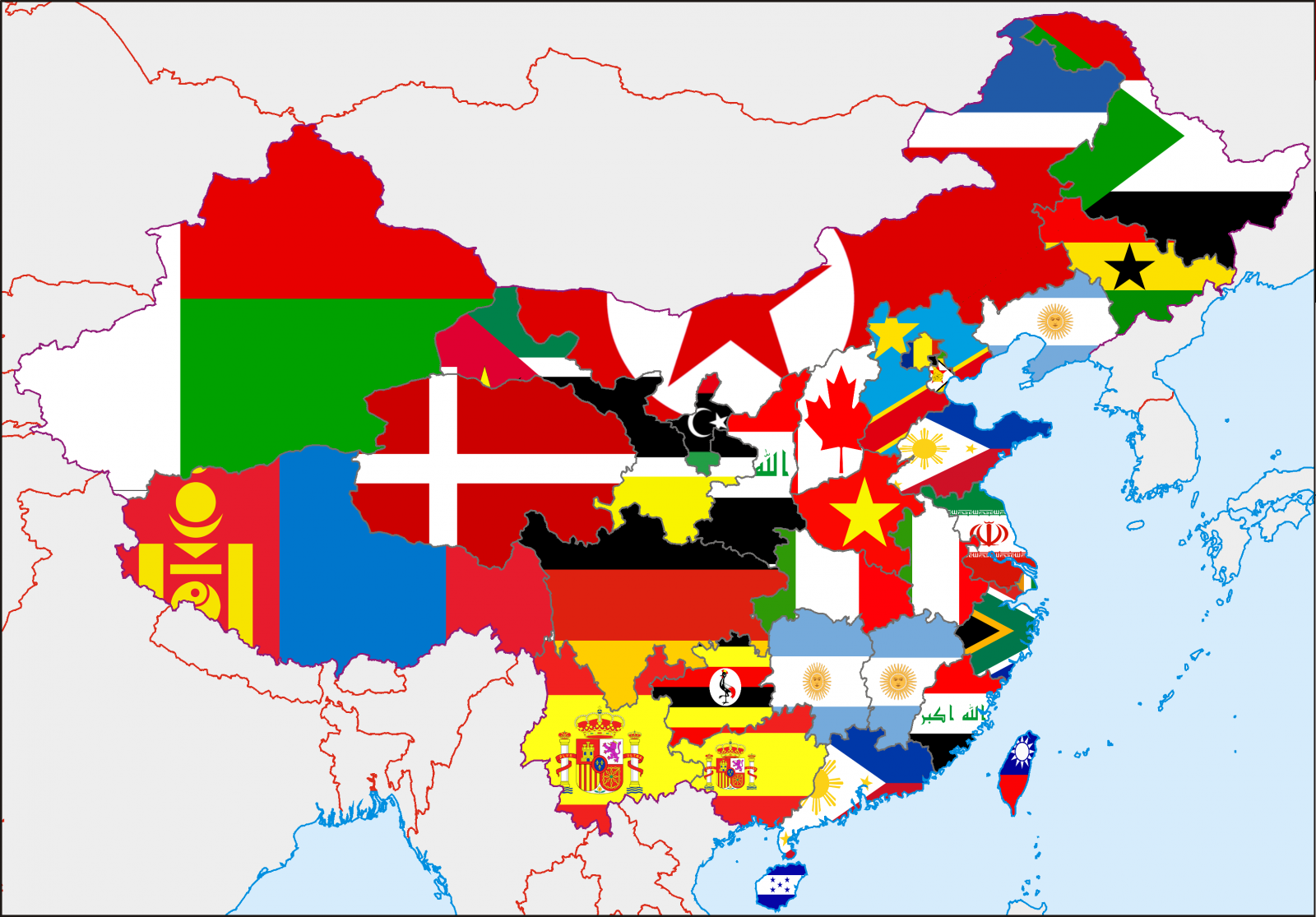
INFOGRAPHIC: How the world would look if countries were scaled according to population
Speaking of which, in case you needed any reminding that there are a lot of people in China, check out these two maps as well. The first divides the world outside of China into areas with a cumulative population equal to that of the PRC (creating a world map eerily similar to that of George Orwell's 1984) and the second superimposes a national flag on every Chinese province, denoting the country with a population most closely resembling that of the province.

DON'T MISS: Canadian Mongolia, Russian Japan and Chinese Ireland: the alternative flags of East Asia
[Images via Reddit, Wikimedia Commons]


0 User Comments